
The sacred heritage of the abbeys and monasteries along the Sarin river has been elected « Landscape of the Year 2018 » . 17 kms of hike, from the Madelaine Hermitage to Hauterive along the Sarin river, you will discover some testimonies of the catholic tradition.
The point of departure of the hike is the Madeleine Hermitage in Räsch, near Düdingen. Situated in the cliff on top of the Schiffenen Lake, it consists of different rooms and has a total length of 120m.
The path under the bridge of the highway continues along the Schiffenen Lake, one of the most recent reservoirs of Switzerland. This narrow lake, similar to a fjord, was finished in 1963.
The path continues via the Grandfey viaduct, on the railway line Bern-Fribourg, which measures 334m of length and 82m of high. This is one of the most impressive bridges of Switzerland.
The path goes past the Auberge aux 4 Vents – an ideal place for a short break – and then turns left direction Palatinat/Sentier du Stand. Via the passerelle des Neigles, you meet the Route des Neigles. Follow this road to the Pont de Berne, the last covered wooden bridge of the town. Enjoy the stroll in the picturesque old town of Fribourg, via the Pont du Milieu, the Karrweg, the Planche Inférieure and the Planche Supérieure, the Chemin du Sonnenberg to the Maigrauge dam. On your way, you see two monasteries – the Montorge monastery and the cistercian Maigrauge abbey. You are then on the Water path « sentier de l’eau, Tour du Lac » and you can easily follow the sign posts. En route, admire the Pérolles Lake, a natural site, discover the historic relics on the beginning of the industrialization in Fribourg and be amazed in front of the fish elevator.
The Guillaume Ritter path takes you along the Sarin river to the Pérolles bridge. There, your itinerary crosses the water path « sentier de l’eau, Tour des trois rivières ». Follow this one in direction of Marly, along the forest, to the Chemin du Riedelet. Then, continue the Route de la Gérine to the wastewater plant (STEP). Just before the STEP, turn left and cross the Gérine river. Along the farms and fields, the itinerary takes you to a bridge and guides you the the Hauterive hydroelectric power station.
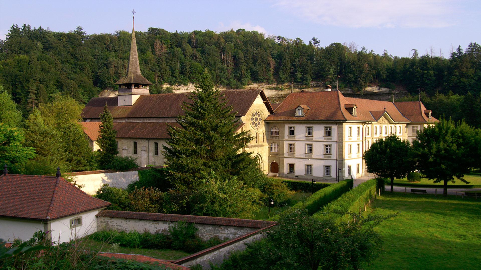
On the Route de l’Abbaye, cross the Sarin river and reach, via the Route d’Hauterive, the Hauterive Abbey and its church of the 13th century. This is a charming Cistercian site where you find a perfect harmony between water, vegetation and stones.
Accessible by public transport: yes
Accessible by car: yes
Properties of the itinerarie
Difficulty: Very easy
Duration: 04:47
Distance: 17 km
Ascent/Descent: +865m / -864m
Altitude min./max.: 535m / 646m